| Can detect objects at remote distances 24 hours a day |
| Laser rangefinder & digital compass |


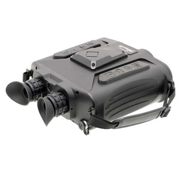
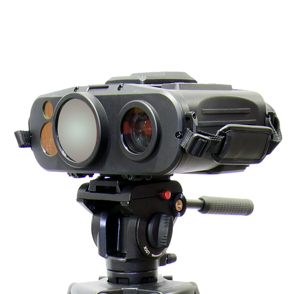
The SENTINEL UMLRF is the most effective cooled handheld multi-functional thermal laser rangefinder binocular available. It serves a wide variety of tactical, law enforcement, border security and special forces applications. SENTINEL UMLRF binoculars use a high-resolution cooled thermal sensor to perceive differences in the thermal signature of objects within the field of view. The unit can detect objects at remote distances 24 hours a day, through smoke, fog or camouflage. The unit’s eye-safe laser rangefinder and digital magnetic compass instantly measure distance, azimuth and inclination of far-off targets. Data is displayed inside the field of view and can be exported via the computer output to a variety of peripheral devices.
| Can detect objects at remote distances 24 hours a day |
| Laser rangefinder & digital compass |
|
Thermal Channel |
|
|
Detector Type |
MCT Cooled |
|
Spectral Band |
MWIR 3 – 5 µm |
|
Resolution |
640 x 512 pixels |
|
Pixel Pitch |
15 µm |
|
NETD @ F1.0 |
≤ 25 mK |
|
MRTD |
≤ 0.2 K |
|
Objective Focal Length |
18 – 275 mm |
|
Field of View – Wide (WFOV) |
30° x 24° |
|
Field of View – Narrow (NFOV) |
2° x 1.6° |
|
Digital Zoom |
1x – 10x |
|
Non-Uniformity Correction |
Automatic |
|
Digital Noise Reduction (DNR) |
Yes |
|
Wide Dynamic Range (WDR) |
Yes |
|
Image Stabilization |
Digital |
|
Polarity |
Hot Black / Hot White |
|
Focus |
Motorized |
|
Video |
PAL / NTSC |
|
4K UHD Day Camera |
|
|
Sensor |
1/2” CMOS |
|
Resolution |
3840 x 2160 (4K UHD) |
|
Objective Focal Length |
6 – 216 mm |
|
Optical Zoom |
36x |
|
Field of View – Wide |
60° to 233° |
|
Field of View – Narrow |
2.4° to 1.2° |
|
Frame Rate |
50 Hz |
|
Image / Thermal Fusion |
Yes – ≥ 3 modes |
|
Laser Rangefinder |
|
|
Laser Type |
1535 nm – eye-safe |
|
Measurement Range |
50 m – 12 km |
|
Ranging Accuracy |
≤ 2 m (target > 50 m) |
|
Accuracy Probability |
≥ 98% |
|
Measurement Rate |
1 Hz (burst: 1 / sec) |
|
Laser Pointer / Marker Detection |
|
|
Detection Wavelengths |
830 nm or 1064 nm |
|
GNSS & Target Location |
|
|
GNSS Constellations |
GPS + Galileo + GLONASS (tri-constellation) |
|
GNSS Position Accuracy |
< 3 m CEP |
|
Target Locating Error |
±5 m (target < 1 km) – ranged-target coordinate accuracy |
|
Target Location Output |
Yes |
|
Coordinate Formats |
Latitude / Longitude + MGRS |
|
Digital Magnetic Compass & Tilt |
|
|
Azimuth Resolution / Accuracy |
0.1° / 0.6° |
|
Elevation Resolution / Accuracy |
0.1° / 0.5° |
|
Elevation Range |
± 40° |
|
Horizontal Range |
360° |
|
Tilt Sensor |
Yes |
|
Recording, Storage & Connectivity |
|
|
Internal Storage |
64 GB built-in (BMP & AVI) |
|
Image Capacity |
≥ 10,000 images |
|
Video Capacity |
≥ 4 hours |
|
Wired Interfaces |
Power input · RS232 or RS422 · USB |
|
Wireless |
Ethernet · Wi-Fi · Bluetooth |
|
Power |
|
|
Battery |
Rechargeable Li-ion (8 pcs) |
|
External / Auxiliary Power |
DC 24V input; AC 240V via charger/PSU |
|
Vehicle Power Compatibility |
Compatible with 24V vehicle supply via external power input |
|
Continuous Operating Time |
> 5 hours @ 25°C (on battery) |
|
Physical & Environmental |
|
|
Dimensions (with eyepiece) |
250 x 240 x 105 mm |
|
Eyepiece Diopter Adjustment (dpt) |
-4 to +4 |
|
Weight (without battery) |
≤ 2.4 kg |
|
Operating Temperature |
-40°C to +60°C |
|
Storage Temperature |
-40°C to +70°C |
|
Waterproof Rating |
IP67 |
|
Mechanical Interface |
1/4” tripod mount |
|
MTTF |
≥ 10,000 hours (system-level) |
|
Remote Control & External Display |
|
|
Control Software |
Dedicated Newcon control application for tablet operation |
|
Connectivity |
Wi-Fi / Bluetooth / Ethernet |
|
Recommended Display |
10.1” rugged Android tablet, MIL-STD-810H |
 |
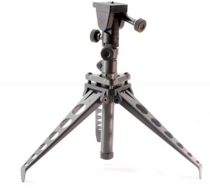 |
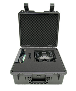
| SENTINEL UMLRF Hard Case | NC SST3-3S Tripod |