

The SENTINEL MLRF is a long-range thermal observation and ranging system designed for military forces, border surveillance units, law enforcement, and special operations teams. The system combines high-performance thermal imaging, precision laser ranging, integrated navigation sensors, and AI-assisted object detection to deliver superior situational awareness in all environmental conditions.
Powered by a 640 × 512 uncooled LWIR thermal sensor, the SENTINEL MLRF enables reliable long-range detection, recognition, and identification (DRI) of targets in total darkness, smoke, fog, and harsh weather environments.
An integrated eye-safe laser rangefinder, digital magnetic compass, and GPS receiver provide precise distance, azimuth, and geolocation data for enhanced battlefield awareness and target reporting.
The system incorporates an AI-enabled processing engine capable of analyzing live video streams and automatically detecting predefined objects, assisting operators in rapidly identifying vehicles, personnel, and other mission-relevant targets.
The MIL-STD ruggedized design ensures reliable performance during continuous 24/7 field deployment in the most demanding operational environments.
Key features :
|
Infrared sensors |
|
|
Detector type |
Vox |
|
Resolution (pixels) |
640×512 |
|
Spectrum (µm) |
8 – 14 |
| Pitch size (µm) | 12 |
|
NETD (mK @F1.0) |
<40 |
|
Frequency (Hz) |
50 |
|
Objective Focal Length (mm) |
50 @F1.0 |
|
Field of View (°) |
8.8 x 7.0 |
|
Non-uniformity correction |
Auto |
|
Detection/Recognition of tank target (km) |
6.3/1.6 |
|
Detection/ Recognition of human target (km) |
2.3/0.6 |
| Digital Noise Reduction (DNR) | Yes |
| Wide dynamic range WDR | Yes |
| Video | PAL/NTSC |
|
Zoom |
1-4x (1-8x optional) |
|
Day channel |
|
|
Objective Focal Length (mm) |
35 |
| Eyepiece Focal Length (mm) | 13.9 |
| Resolution (pixels) | 1280×1024 |
| Frequency (Hz) | 30 |
|
Field of View (°) |
12.4 x 7.0 |
|
Zoom |
1-4x (1-8x optional) |
|
LRF |
|
|
Laser type |
Semiconductor laser, Class I |
|
Laser wavelength (μm) |
1,550 |
|
Detection range (m) |
20 – 7,000, ( 20 – 10,000 Optional) |
|
Ranging accuracy (m) |
±2 |
| Laser pointer | |
|
Wavelength (nm) |
850 (IR) |
|
GPS |
|
|
Type |
GPS, Galileo (GNSS) |
|
Target locating error |
±5M (target<1km) |
|
Format |
Lat/Long and MGRS |
|
Wi-Fi |
Optional |
| Fusion | |
|
Combing day and thermal image |
Yes |
| Fusion modes | Multi-sensor fusion (thermal, day, low-light) |
|
Magnetic compass |
|
|
Azimuth resolution/accuracy |
1°/ 1° |
|
Elevation resolution/accuracy |
1°/ 1° |
| Elevation range | +/- 80° |
|
Mechanics & Environmental |
|
|
Interpupillary distance (mm) |
64 |
|
Eyepiece diopter adjustment (dpt) |
±5 |
|
Internal video & photo recording |
64 GB built-in (BMP & AVI), ≥ 4 hours or ≥ 10,000 images |
|
Connectivity |
Power input, RS232 (remote control), USB (output videos and images) |
|
Continuous working time (hours) |
Up to 6 hours when LRF measurements are disabled |
|
Dimensions with eyepiece (mm) |
190 x 160 x 85 |
|
Weight without battery (kg) |
1.45 |
|
Power |
Internal battery: rechargeable 4×18650, DC power supply 12VDC |
|
Temperature range (°C) |
-30 to +60 |
|
Storage temperature range (°C) |
-35 to +65 |
| Waterproof | MIL STD 810 (1m for 30 min) |
|
Mechanical interface/mounts |
1/4′ tripod mount |
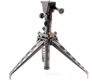 |
||
| NC SST3-3S Tripod |


