| High-resolution uncooled thermal sensor |
| Can detect objects at remote distances 24 hours a day |
| Laser rangefinder & digital compass |


The SENTINEL SMLRF is a mission-critical, multi-functional thermal binocular system engineered for elite tactical units operating in complex and high-risk environments. Equipped with high-resolution uncooled LWIR and SWIR sensors, and an integrated eye-safe laser rangefinder rated for distances up to 10,000 meters, the SENTINEL SMLRF delivers unmatched long-range detection and engagement capabilities. It enables operators to identify human targets at up to 2.3 km and vehicles at 6.3 km—through smoke, fog, or camouflage—ensuring 24/7 operational effectiveness.
The system integrates GPS positioning, a digital magnetic compass, and multiple image fusion modes to provide real-time, in-view data on target location, azimuth, and inclination. Onboard video and photo recording, silent operation, and versatile connectivity options enhance mission documentation and communication.
Built to MIL-STD 810 standards, it operates in extreme conditions and withstands rugged use in the field. Compact, reliable, and highly mobile, the SENTINEL SMLRF delivers the advanced situational awareness and precision targeting essential to today’s most demanding tactical missions.
| High-resolution uncooled thermal sensor |
| Can detect objects at remote distances 24 hours a day |
| Laser rangefinder & digital compass |
|
Infrared sensors |
|
|
Detector type |
Vox |
|
Resolution (pixels) |
640×512 |
|
Spectrum (µm) |
8 – 14 |
|
Pitch Size |
12 |
|
NETD (mK @F1.0) |
<40 |
|
Frequency (Hz) |
50 |
|
Objective Focal Length (mm) |
50 @F1.0 |
|
Field of View (°) |
8.8 x 7.0 |
|
Non-uniformity correction |
Auto |
|
Detection/Recognition of tank target (km) |
6.3/1.6 |
|
Detection/ Recognition of human target (km) |
2.3/0.6 |
|
Zoom |
1-4x |
|
SWIR |
|
|
Objective Focal Length (mm) |
50 |
| Resolution (pixels) | 640×512 |
| Frequency (Hz) | 50 |
|
Field of View (°) |
8.8 x 7 |
|
Zoom |
1-4x |
|
Spectrum (μm) |
0.9 – 1.7 |
|
LRF |
|
|
Laser type |
Semiconductor laser, Class I |
|
Laser wavelength (μm) |
1,550 |
|
Detection range (m) |
20 – 5,000, ( 20 – 10,000 Optional) |
|
Ranging accuracy (m) |
±2 |
|
GPS |
|
|
Type |
GPS, Galileo (GNSS) |
|
Target locating error |
±5M (target<1km) |
|
Format |
Lat/Long and MGRS |
| Fusion | |
|
Combing day and thermal image |
Yes |
| Fusion modes | At least 3 modes of image combining |
|
Magnetic compass |
|
|
Azimuth resolution/accuracy |
1°/ 1° |
|
Elevation resolution/accuracy |
1°/ 1° |
| Elevation range | +/- 80° |
|
Mechanics & Environmental |
|
|
Interpupillary distance (mm) |
64 |
|
Eyepiece diopter adjustment (dpt) |
±5 |
|
Internal video & photo recording |
64 GB built-in (BMP & AVI), ≥ 4 hours or ≥ 10,000 images |
|
Connectivity |
Power input, RS232 (remote control), USB (output videos and images), PAL video |
|
Continuous working time (hours) |
4 |
|
Dimensions with eyepiece (mm) |
170 x 210 x90 |
|
Weight without battery (kg) |
Max 2kg |
|
Power |
Internal battery: rechargeable 4×18650, DC power supply 12VDC |
|
Temperature range (°C) |
-30 to +60 |
|
Storage temperature range (°C) |
-35 to +65 |
| Waterproof | MIL STD 810 (1m for 30 min) |
|
Mechanical interface/mounts |
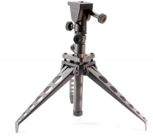
1/4′ tripod mount |
|
Wi-Fi |
Optional |