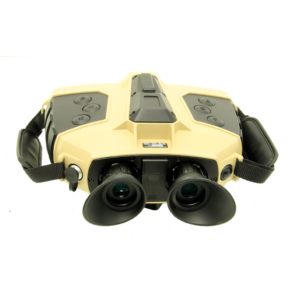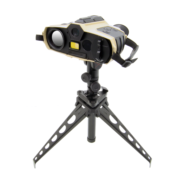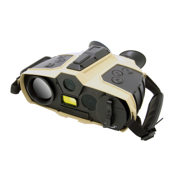

The SENTINEL MLRF X is a ruggedized, multi-sensor thermal imaging and observation binocular designed for conventional forces, special operations forces, and homeland security units operating in the High North and Arctic environment. The system delivers ISR, target acquisition, and situational awareness across day, night, and degraded visual environments — including polar darkness, white-out, blowing snow, and the contested electromagnetic conditions characteristic of Arctic operations.
A 640 × 512 uncooled thermal imaging sensor provides long-range detection and classification under all weather conditions, while an AI-enabled processing engine analyzes live video in real time to automatically detect vehicles, vessels, and personnel — accelerating threat identification across featureless Arctic terrain and maritime littoral zones. A complementary direct view optical channel provides 7× magnification, 7° field of view, and ±5 SD visual acuity to support sustained observation during extended High North patrols. The system incorporates an eye-safe laser rangefinder with 10 km ranging capability, digital magnetic compass, and embedded GPS, enabling real-time range, azimuth, and target location in GPS-degraded and magnetically anomalous Arctic environments. This sensor-to-decision capability supports maritime domain awareness, call-for-fire, and network-enabled operations aligned to Arctic experimentation objectives. Engineered to MIL-STD durability standards, the SENTINEL MLRF X is optimized for 24/7 continuous operations in the austere and strategically contested High North.
|
Infrared sensors |
|
|
Detector type |
Vox |
|
Resolution (pixels) |
640×512 |
|
Spectrum (µm) |
8 – 14 |
| Pitch size (µm) | 12 |
|
NETD (mK @F1.0) |
<40 |
|
Frequency (Hz) |
50 |
|
Objective Focal Length (mm) |
50 @F1.0 |
|
Field of View (°) |
8.8 x 7.0 |
|
Non-uniformity correction |
Auto |
|
Detection/Recognition of tank target (km) |
6.3/1.6 |
|
Detection/ Recognition of human target (km) |
2.3/0.6 |
| Digital Noise Reduction (DNR) | Yes |
| Wide dynamic range WDR | Yes |
| Video | PAL/NTSC |
|
Zoom |
1-10x |
|
Day channel |
|
|
Objective Focal Length (mm) |
35 |
| Eyepiece Focal Length (mm) | 13.9 |
| Resolution (pixels) | 1280×1024 |
| Frequency (Hz) | 30 |
|
Field of View (°) |
12.4 x 7.0 |
|
Zoom |
1-10x |
|
LRF |
|
|
Laser type |
Semiconductor laser, Class I |
|
Laser wavelength (μm) |
1,550 |
|
Detection range (m) |
20 – 10,000 |
|
Ranging accuracy (m) |
±2 |
| Laser pointer | |
|
Wavelength (nm) |
850 (IR) |
|
GPS |
|
|
Type |
GPS, Galileo (GNSS) |
|
Target locating error |
±5M (target<1km) |
|
Format |
Lat/Long and MGRS |
|
Wi-Fi |
Optional |
| Fusion | |
|
Combing day and thermal image |
Yes |
| Fusion modes | At least 3 modes of image combining |
|
Magnetic compass |
|
|
Azimuth resolution/accuracy |
1°/ 1° |
|
Elevation resolution/accuracy |
1°/ 1° |
| Elevation range | +/- 80° |
|
Mechanics & Environmental |
|
|
Interpupillary distance (mm) |
64 |
|
Eyepiece diopter adjustment (dpt) |
±5 |
|
Internal video & photo recording |
64 GB built-in (BMP & AVI), ≥ 4 hours or ≥ 10,000 images |
|
Connectivity |
Power input, RS232 (remote control), USB (output videos and images) |
| Peripheral Compatibility | Bal Comp, AFS, PC, AndroidTM, Available plug-ins for CivTAK/ATAK |
|
Continuous working time (hours) |
Up to 6 hours when LRF measurements are disabled |
|
Dimensions with eyepiece (mm) |
190 x 160 x 90 |
|
Weight without battery (kg) |
1.50 |
|
Power |
Internal battery: rechargeable 4×18650, DC power supply 12VDC |
|
Temperature range (°C) |
-30 to +60 |
|
Storage temperature range (°C) |
-35 to +65 |
| Waterproof | MIL STD 810 (1m for 30 min) |
|
Mechanical interface/mounts |
1/4′ tripod mount |
 |
||
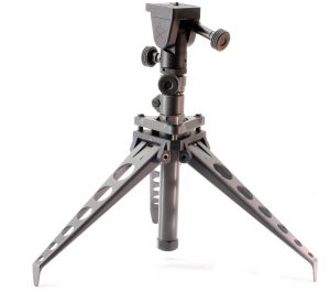
| NC SST3-3S Tripod |